


Difficulty
intermediate
Viz (last reported 24785h ago)
Max Depth
Unknown
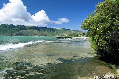
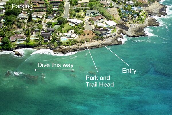
Snorkeling and Scuba Diving at Koko Kai Park
Koko Kai Park is mostly used as an entry for the previous site, Koke'e Park. It has a natural ledge that you may step on -- to do your giant stride on the next incoming swell. Exit is not easy at this site, which is why most will wait until the incoming tide, and then drift/swim to Koke'e Park beach. We recommend a guide to assist you with the first dive at this site.
Take Kalanianaole Highway (72) East toward Koko Head. Before heading up the side of Koko Head, turn right on Nawiliwili Street. After .3 miles turn left onto Poipu Drive. Bear right. After .6 miles turn right onto Hanapepe Loop. Bear Left. After .25 miles turn right into the park area.
Access
shore

View
Nearby Shops
Tide Report
5
4
3
2
1
(15)
Currently viewing a specific review. View all reviews

David from Honolulu
Apr 2, 2012, 12:00 AM
scuba
Entry wasn't bad, but exiting is rough. We actually dove to the East/South to see some of the wall and reef. Not much coral or marine life was around and the current was pushing us around a good bit. Going away from the shoreline a good ways and the shelf drops to ~50ft, but there still isn't much out there. Bottom line - I DO NOT recommend this for anyone that isn't going with someone that knows exactly what they are doing and has experience with the area (that may, potentially, know better spots than what we saw). Currents are strong, exit is scary, and there isn't much to see. Go sit on the rocks some day just to hang out. That's what the spot is good for - not diving.
Other Locations Nearby