


Difficulty
intermediate
Viz (last reported 25233h ago)
Max Depth
Unknown
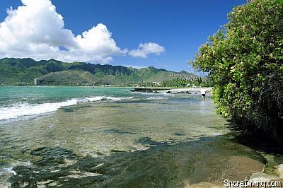
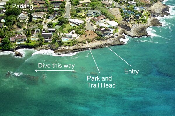
Snorkeling and Scuba Diving at Koko Kai Park
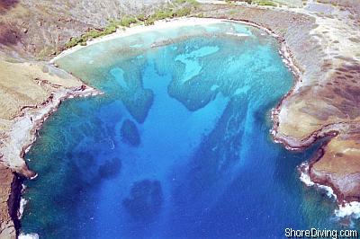
Koko Kai Park is mostly used as an entry for the previous site, Koke'e Park. It has a natural ledge that you may step on -- to do your giant stride on the next incoming swell. Exit is not easy at this site, which is why most will wait until the incoming tide, and then drift/swim to Koke'e Park beach. We recommend a guide to assist you with the first dive at this site.
Take Kalanianaole Highway (72) East toward Koko Head. Before heading up the side of Koko Head, turn right on Nawiliwili Street. After .3 miles turn left onto Poipu Drive. Bear right. After .6 miles turn right onto Hanapepe Loop. Bear Left. After .25 miles turn right into the park area.
Access
shore

View
Nearby Shops
Tide Report
5
4
3
2
1
(15)
Currently viewing a specific review. View all reviews

Deven Phillips
Apr 15, 2002, 12:00 AM
scuba
The wall entry is actually a little intimidating, but not difficult. The exit is a little difficult and not recommended in higher surf (3-4 ft.). There are many different varieties of fish and eels. Many sea turtles can be spotted. Avoid entering the canyons too far, as they narrow and the surge could cause injury. If you swim far enough out toward Hanauma Bay, you will see several sea caves with a multitude of fish. I have been told that sometimes sharks can hang out in these caves, but I have not seen them.
Other Locations Nearby