Difficulty
Unrated
Viz (last reported 102506h ago)
Max Depth
Unknown
Snorkeling and Scuba Diving at La Jennelle Park
This is a good dive for the adventurers among you! After a long drive through areas you have never been before, you'll find sandy parking and a rocky entry. But beyond that, you'll discover some excellent diving for all skill levels.
From Highway 101 near Oxnard, take the Victoria Exit South toward Port Hueneme. Drive 6.7 miles to a stop sign. Turn left onto Roosevelt, which becomes Island View Ave. In 3/4 mile turn right on Sawtelle Ave. You'll soon arrive at the picture below.
Access
shore
Nearby Shops
Tide Report
8
5
4
3
2
1
(9)


Zentacle
Sep 21, 2021, 1:05 AM
scuba
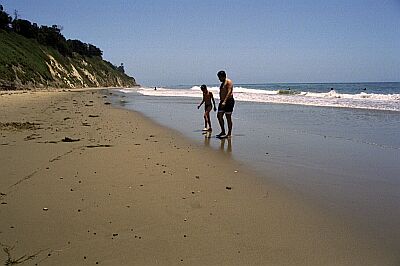
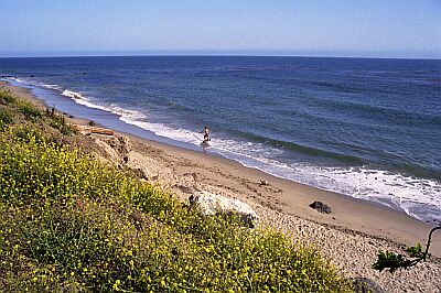
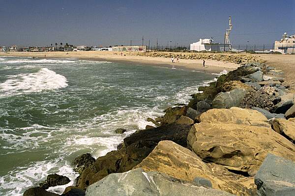
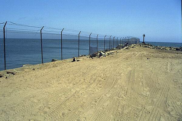
This is the parking for the less-adventurous. To get 100 yards closer to the entry, take your 4-wheeled drive vehicle down the soft sand trail (lower left of picture) to the next parking area.
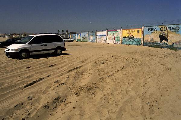
The corner of Ocean Drive and Sawtelle, with the Navy Base to the left. Enter through the sand road by the fence.
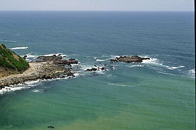
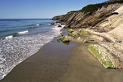
If the ocean conditions are favorable, you can enter at the point.
If the ocean conditions are NOT favorable, you can usually find a break in the fence, and scurry over the rocks for a protected entry.
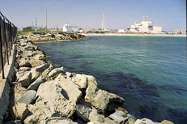
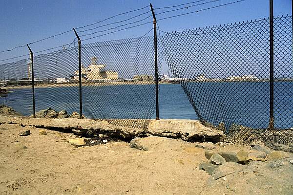
This is the Navy base in the background. Do no go that direction!
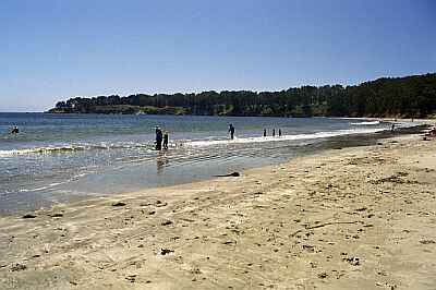
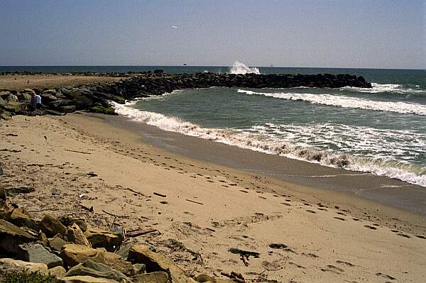
This is a view of the point. A short kick, and you'll find yourself in deep, clear water.
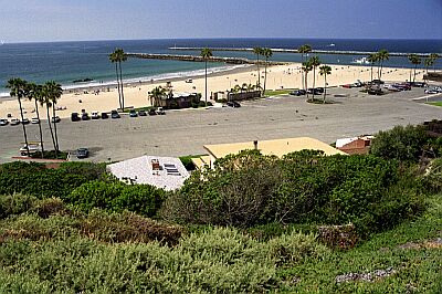
The next parking area is beyond the concrete wall, to the right. By the way, what's that object in the foreground? Part of the 400 foot passenger boat (La Jennelle) that sank here in 1970. One of the few places you can actually do a wreck dive and not get wet! Check out the plaque in the area for the ship's history.
7
Rey Pasmant
Sep 15, 2013, 12:00 AM
scuba
I've been diving the area there since 1969, Late summer and fall are the best time to dive this spot. I've had close encounters with very cool sea life whales, seals, jellies that light up like a UFO. And more.
Originally posted on shorediving.com
Ray Tarr
Jun 13, 2009, 12:00 AM
scuba
This is one of the best spots for sheep crap that I have been to. Pismo clams are abundant and hefty. I generally get my limit of clams in less than 300 PSI and spend the rest of my tank hitting the jetty. There is good lobster hunting but most are backed up to deep holes and they squirt into the holes pretty quickly. I speared a number of large Cabazon in the area as well. Swell can be a factor when first entering the surf but if you put your gear/fins on upon initial entry, you can power your way through the surf to the backside of the waves. There are still a lot of pieces of the La Jennelle wreck scattered out from the tip of the jetty in the deeper parts of the site.
Originally posted on shorediving.com
Joseph D
Mar 13, 2007, 12:00 AM
scuba
Excellent local dive, with a vis of about 10ft. Wide variety of gorgonians, some sheep crab (up to 3ft.), a few lobster and an assortment of fish. Not too much to see below 70ft.
Originally posted on shorediving.com
Rickster
Dec 3, 2005, 12:00 AM
scuba
Great dive! The fence along the jetty was removed, and there is now access back to the wall on the port side. I have made several dives on both sides of the jetty. The port side is calm, good vis, lots of fish, and rocks, small kelp beds, and sand with sand dollar beds. The depth is 10-20 feet. The ocean side is for more experienced divers. Rocks go down about 30-35 feet, then sand slopes down at a good angle. Lots of gregorians, fish and, Rocks! Could be surgy at times, so watch the waves on the rocks! This site is highly recommended.
Originally posted on shorediving.com
Originally posted on shorediving.com
TJ
Jun 27, 2004, 12:00 AM
scuba
This dive site gives you the best of several worlds, it has aspects of a deep dive, a wreck dive, and a wall dive, with good game, and good viz. Entry is easy, (on a good day), just slip in right at the corner of the fence, and head out to the point. Watch for fishermen, and fishing line, otherwise, a nice site.
Originally posted on shorediving.com
Mark Conyers
Apr 1, 2003, 12:00 AM
scuba
If your looking for a local deep dive, this is a good spot, 120+FSW. The fence has been cut back making an entry on the left side Much easier. Timing the swells can be the key to good entry/exit here. Bottom is very silty away from the jetty.
Originally posted on shorediving.com
James Sperling
Aug 1, 2002, 12:00 AM
scuba
This dive site is ok. All of the people that said the visibility was not good here and they were right. 6-8 feet at best; I guess timing is everything. The coolest part of the dive was a seal that was sleeping, I guess in a piece of the La Jennelle ship wreck, and when we approached he swam off. Getting in and out of the water was the worst! If you're not careful you will get smashed into the rocks by the waves. Sea life was OK. If you paid money to go on a vacation, don't go here! But it is a decent place to explore if you're a local.
Originally posted on shorediving.com
Other Locations Nearby